


- 20 Songs That Became Unofficial National Anthems - June 20, 2026
- How Forgotten Authors Changed Modern American Literature - June 20, 2026
- Books That Captured the American Experience Across Centuries - June 19, 2026
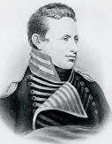
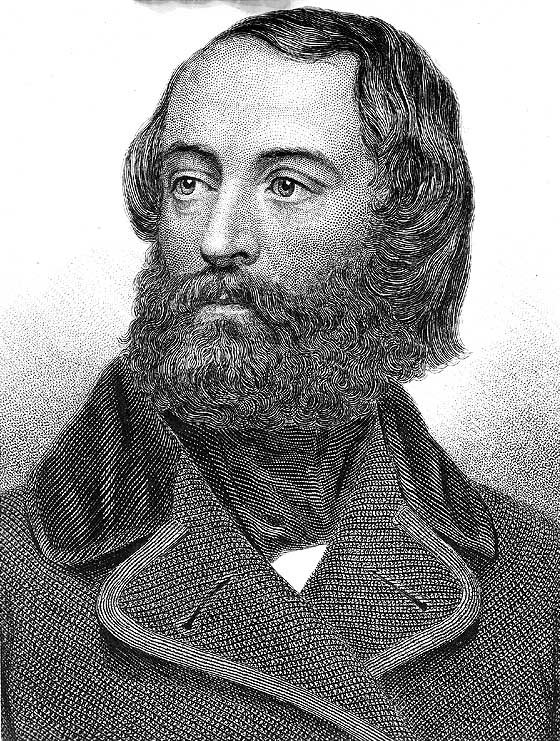
Jedediah Smith: The First American to Cross the Sierra Nevada

When most people think of American exploration, Lewis and Clark dominate the conversation. But Jedediah Strong Smith was an American clerk, transcontinental pioneer, frontiersman, hunter, trapper, author, cartographer, mountain man and explorer of the Rocky Mountains, the Western United States, and the Southwest during the early 19th century. After 75 years of obscurity following his death, Smith was rediscovered as the American whose explorations led to the use of the 20-mile wide South Pass as the dominant route across the Continental Divide for pioneers on the Oregon Trail.
His explorations were significant in opening the American West and he was the first white man to cross what would become Utah and Nevada, the first to enter California by the overland route, to cross the High Sierras, and the first explorer to reach Oregon overland by traveling up the California coast. In the winter of 1824, Smith and his group of trappers rediscovered South Pass through the Rocky Mountains. The pass (in Wyoming) had been forgotten for a decade. This was an important discovery, for this pass was then used by thousands of Americans as they moved to Oregon and California.
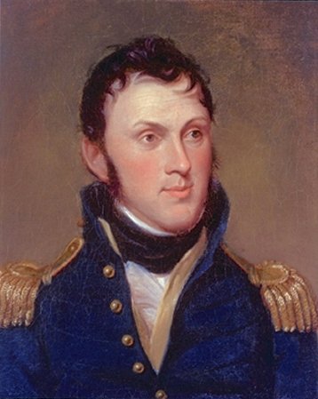
Zebulon Pike: Beyond the Peak
Zebulon Montgomery Pike was an American brigadier general and explorer for whom Pikes Peak in Colorado is named. As a U.S. Army officer he led two expeditions through the Louisiana Purchase territory, first in 1805–1806 to reconnoiter the upper northern reaches of the Mississippi River, and then in 1806–1807 to explore the southwest to the fringes of the northern Spanish-colonial settlements of New Mexico and Texas. On November 15, Pike recorded the first sight of the distant mountain Tava which he called “Grand Peak”. It has since been called Pikes Peak in his honor.
Pike wrote an account of his expeditions, some of which had to be recreated from memory, which was published in 1810 as The expeditions of Zebulon Montgomery Pike to Headwaters of the Mississippi River, through Louisiana Territory, and in New Spain, during the Years 1805–6–7. These journals and maps gave Americans important information about trade opportunities along with the blueprints for the Santa Fe Trail. Despite the setbacks, Pike’s detailed observations and notes contributed to American understanding of the Southwest, influencing perceptions of the region’s geography and its potential for trade. His accounts shaped narratives about the American frontier and left a lasting legacy on the history of exploration in the United States.
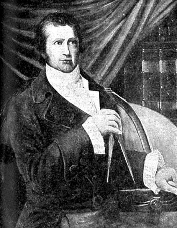
Thomas Freeman: The Red River Pathfinder
As such, use of this image in the jurisdiction of the claimant or other countries may be regarded as copyright infringement. Please see Commons:When to use the PD-Art tag for more information., Public domain, https://commons.wikimedia.org/w/index.php?curid=6420554)
While Pike gets credit for southwestern exploration, Thomas Freeman led one of the most significant yet underappreciated expeditions in American history. The Freeman-Custis Expedition of 1806 was tasked with exploring the Red River and establishing the U.S.-Spanish border in the Louisiana Territory. Freeman’s mission was to map the southern boundary of the Louisiana Purchase, a task that would prove more politically sensitive than anyone anticipated.
Freeman’s expedition faced Spanish military opposition that ultimately forced them to turn back after reaching only 615 miles up the Red River. However, his detailed scientific observations and mapping work provided crucial intelligence about the borderlands. The expedition collected extensive botanical and zoological specimens, and Freeman’s cartographic work helped establish American claims to the region that would later become essential during the Mexican-American War negotiations.
Joseph Walker: Master of the Sierra Nevada
Joseph Walker stands as one of the most skilled mountain men and pathfinders of the American West. His 1833 expedition across the Sierra Nevada established what would become a crucial segment of the California Trail. Walker’s route through the mountains was so well-chosen that it remained a primary path for emigrants heading to California during the Gold Rush era.
Walker’s expertise in reading terrain and finding water sources made him invaluable to westward expansion. He led numerous expeditions through Nevada and California, mapping previously unknown territories and establishing relationships with Native American tribes. His knowledge of the Great Basin and Sierra Nevada was unmatched, and his routes saved countless lives by avoiding dangerous terrain that had trapped other parties.
Stephen H. Long: Debunking the Great American Desert
Major Stephen Long’s expeditions to the Great Plains and Rocky Mountains fundamentally changed American perceptions of the western territories. His 1820 expedition through present-day Colorado, Nebraska, and Kansas produced detailed maps and scientific observations that corrected many misconceptions about the region’s geography and climate.
Long’s most significant contribution was his systematic documentation of the Great Plains environment. While he initially described parts of the region as unsuitable for agriculture—coining the term “Great American Desert”—his detailed botanical and geological surveys provided the foundation for later understanding of the area’s potential. His maps and reports influenced government policy and settlement patterns for decades.
John Wesley Powell: One-Armed Giant of the Colorado

Few explorers faced challenges as daunting as John Wesley Powell’s navigation of the Colorado River through the Grand Canyon. Pike’s second expedition crossed the Rocky Mountains into what is now southern Colorado, which led to his capture by the Spanish colonial authorities near Santa Fe, who sent Pike and his men to Chihuahua (present-day Mexico) for interrogation. Powell, having lost his right arm in the Civil War, led his crew through 1,000 miles of uncharted river in 1869, creating the first comprehensive maps of the Colorado River system.
Powell’s expedition was as much about scientific discovery as adventure. He conducted extensive geological surveys, documented Native American ruins, and produced detailed topographical maps that remain remarkably accurate today. His work laid the foundation for understanding the hydrology and geology of the American Southwest, influencing water policy and conservation efforts that continue today.
Francisco Vázquez de Coronado: Spanish Colonial Pathmaker
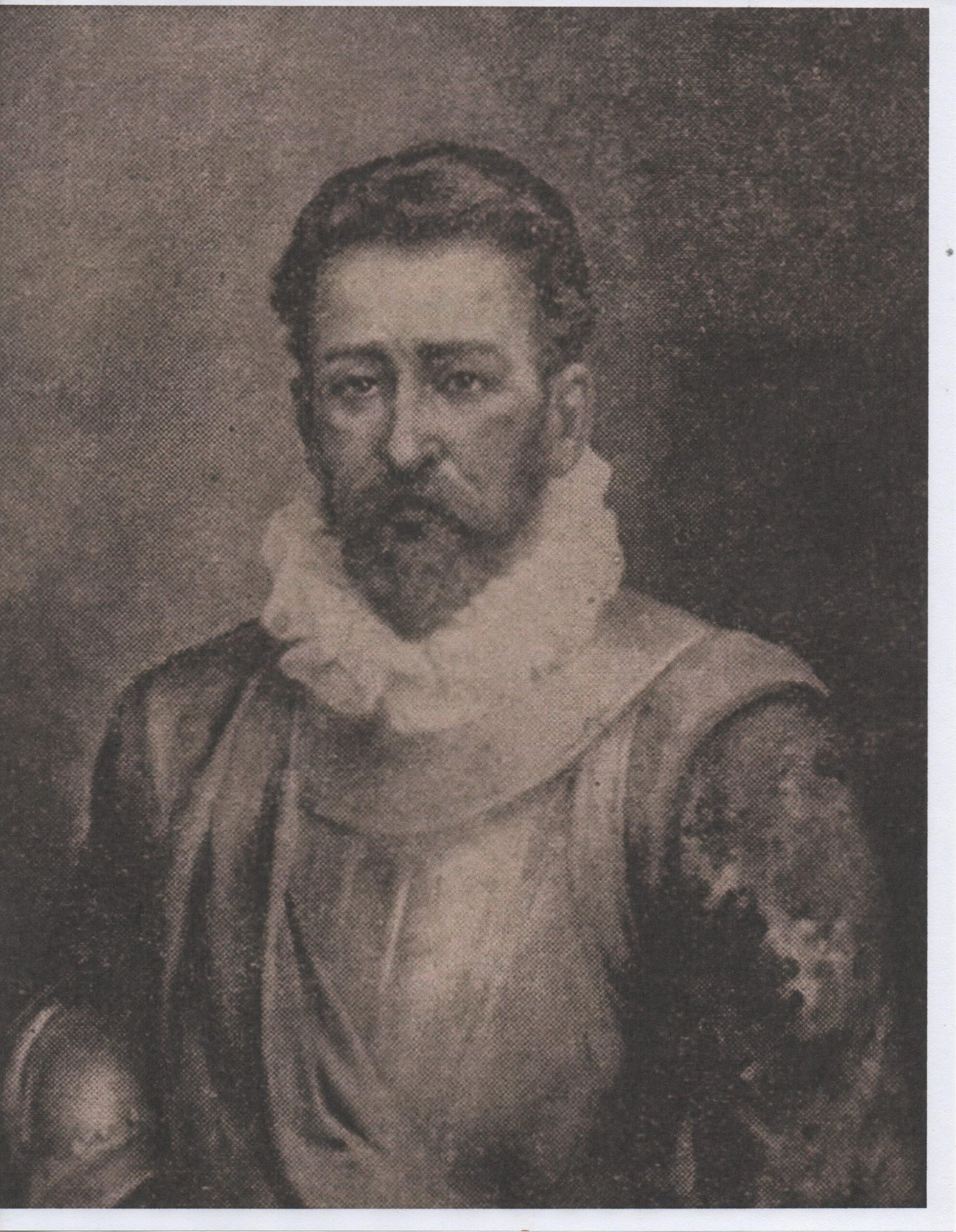
Though born in Spain, Coronado’s 1540s expedition through the American Southwest established territorial claims and geographic knowledge that would later influence U.S. expansion. His journey from Mexico through present-day Arizona, New Mexico, Texas, Oklahoma, and Kansas created the first European maps of vast portions of the American interior.
Coronado’s expedition covered over 4,000 miles and provided detailed observations of Native American settlements, natural resources, and geographic features. While his search for the mythical Seven Cities of Gold proved fruitless, his documentation of the region’s geography and ethnography became invaluable to later American explorers and territorial administrators. His routes would later influence American military campaigns during the Mexican-American War.
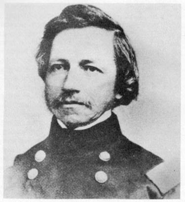
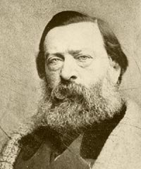
Amiel Weeks Whipple: Railroad Route Pioneer
National Archives and Records Administration (NARA) Brady Image Collection, National Archives and Records Administration, Public domain, https://commons.wikimedia.org/w/index.php?curid=1131259)
Lieutenant Amiel Weeks Whipple’s 1853-1854 survey along the 35th parallel represents one of the most significant yet overlooked mapping achievements in American history. Tasked with finding a viable transcontinental railroad route, Whipple’s expedition covered over 2,000 miles from Fort Smith, Arkansas, to Los Angeles, California.
Whipple’s survey produced incredibly detailed maps, astronomical observations, and scientific collections that filled 12 volumes of reports. His route through Oklahoma, Texas, New Mexico, Arizona, and California identified the most practical southern path for a transcontinental railroad. Though the Civil War delayed construction, portions of his route were eventually used by the Atchison, Topeka and Santa Fe Railway, directly contributing to the development of the American Southwest.
James Ohio Pattie: Mountain Man Chronicler
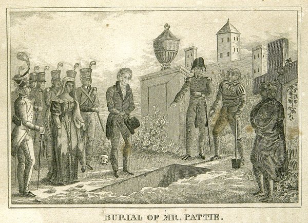
James Ohio Pattie’s adventures through the Southwest and Baja California in the 1820s provided Americans with some of their first detailed accounts of these remote regions. His personal narrative, published in 1831, described encounters with Apache and Comanche tribes, detailed descriptions of desert survival, and observations of Mexican California before American conquest.
Pattie’s explorations took him through present-day New Mexico, Arizona, and into Baja California, where he was imprisoned by Mexican authorities. His eventual release and return to the United States provided valuable intelligence about Mexican military positions and political conditions. His published account became one of the most widely read exploration narratives of the era, influencing public opinion about western expansion.
Benjamin Bonneville: Military Mapmaker of the West
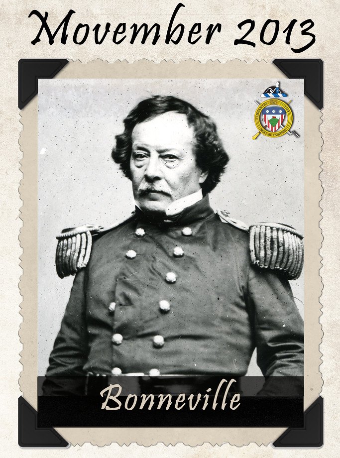
Captain Benjamin Bonneville’s three-year exploration of Wyoming, Idaho, and Oregon between 1832 and 1835 produced some of the most accurate early maps of the northern Rockies. His expedition, though officially unauthorized by the U.S. Army, gathered crucial intelligence about British activities in the Oregon Territory and documented Native American trade routes.
Bonneville’s maps corrected numerous errors in previous cartographic work and provided detailed information about mountain passes, river systems, and seasonal weather patterns. His observations of British Hudson’s Bay Company operations provided the U.S. government with strategic intelligence during territorial negotiations. Washington Irving later immortalized Bonneville’s adventures in “The Adventures of Captain Bonneville,” bringing his achievements to national attention.
Elisha Kent Kane: Arctic Cartographer
Dr. Elisha Kent Kane’s Arctic expeditions in search of the lost Franklin Expedition advanced American knowledge of polar geography more than any previous efforts. His two expeditions between 1850 and 1855 mapped previously unknown regions of Greenland and the Canadian Arctic, discovering Kane Basin and proving that Greenland extended much farther north than previously believed.
Kane’s detailed observations of Arctic ice patterns, weather systems, and Inuit survival techniques provided valuable scientific data. His maps and journals became standard references for subsequent Arctic explorers. Despite facing extreme hardships, including scurvy and ice entrapment, Kane’s expeditions established American credibility in polar exploration and contributed significantly to 19th-century geographic knowledge.
Isaac Israel Hayes: Polar Pioneer
Following in Kane’s footsteps, Dr. Isaac Israel Hayes led his own Arctic expedition in 1860-1861, pushing even farther north than his predecessor. Hayes’s expedition reached 81°35′ North latitude, setting a new record for northernmost exploration at the time. His detailed astronomical observations and mapping work corrected several errors in previous Arctic charts.
Hayes’s expedition produced extensive meteorological data, botanical collections, and ethnographic observations of Inuit culture. His book “The Open Polar Sea” became a bestseller and influenced public support for Arctic exploration. Hayes’s careful documentation of ice movements and weather patterns contributed to understanding of Arctic climate systems that proved valuable for later scientific expeditions and commercial ventures.
Adolphus Greely: Tragic Hero of the Arctic
General Adolphus Greely’s Lady Franklin Bay Expedition (1881-1884) ended in tragedy but produced invaluable scientific data about the Arctic. As part of the First International Polar Year, Greely’s team established a meteorological station in the Canadian Arctic and conducted extensive magnetic and atmospheric observations.
Despite losing 18 of his 25 men to starvation and cold, Greely’s expedition collected two years of continuous weather data, made important geographic discoveries, and advanced understanding of Arctic phenomena. His detailed records of ice formation, magnetic variations, and atmospheric conditions provided crucial baseline data for climate science. Greely’s survival and rescue made him a national hero, and his scientific contributions influenced polar research for decades.
Peter Skene Ogden: Hudson’s Bay Pathfinder

Peter Skene Ogden’s explorations for the Hudson’s Bay Company mapped vast regions of the interior Northwest, Utah, and California between 1824 and 1830. His expeditions covered over 50,000 miles and established trade routes that connected British North America with Mexican California. Ogden’s detailed journals and maps provided the most comprehensive geographic knowledge of the Great Basin region.
Ogden’s discovery of the Humboldt River in Nevada provided a crucial water source for later emigrants on the California Trail. His explorations of the Snake River country, central Oregon, and northern California corrected numerous cartographic errors and identified previously unknown mountain passes. His work directly influenced both British territorial claims and American westward expansion routes.
Robert Stuart: Discoverer of South Pass
Robert Stuart’s eastbound journey from Astoria in 1812-1813 led to the discovery of South Pass, though his achievement remained largely unknown until Jedediah Smith’s later rediscovery. Stuart’s small party found the wide, gentle passage through the Rocky Mountains that would later become the main route for the Oregon Trail, California Trail, and Mormon Trail.
Stuart’s detailed journal described not only the geographic features of South Pass but also documented Native American trails, seasonal migration patterns, and natural resources throughout Wyoming and Nebraska. His observations of buffalo herds, river systems, and weather patterns provided valuable intelligence for later emigrants. Stuart’s route became the template for the most important overland trail in American history.
David Thompson: British Mapmaker of American Territory
Though Canadian, David Thompson’s extensive mapping of the Pacific Northwest directly impacted American territorial claims and settlement patterns. Thompson spent the next few seasons trading based in Fort George (now in Alberta), and during this time led several expeditions into the Rocky Mountains. In 1811/1812 he followed the Columbia River to the Pacific, and in 1814 used his notes and measurements to draft the first European-style map of western Canada, covering 3.9 million square kilometres.
Thompson’s map was so accurate that it remained the standard reference for the region until the late 19th century. His detailed surveys of the Columbia River system, mountain passes, and tribal territories provided crucial intelligence during U.S.-British negotiations over the Oregon Territory. American explorers and settlers regularly used Thompson’s maps, making his work essential to American westward expansion despite his British allegiance.
Andrew Ellicott: Boundary Surveyor Extraordinary
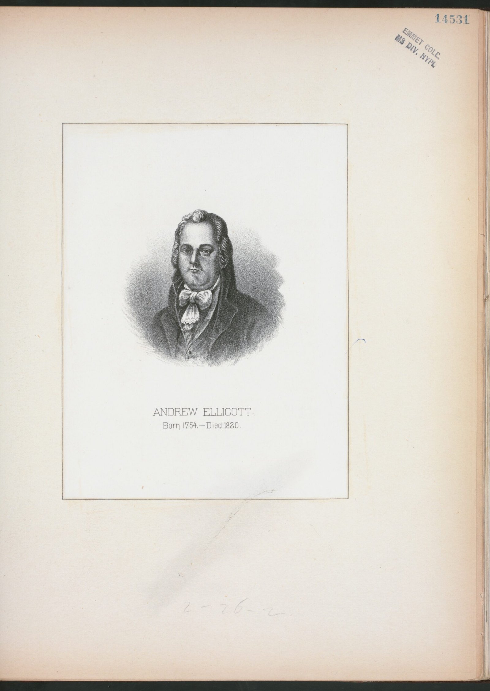
Andrew Ellicott’s surveying work established many of the fundamental boundaries that define American geography today. His completion of the Mason-Dixon Line survey and his establishment of the boundaries of the District of Columbia created lasting geographic markers. Ellicott also surveyed the western boundary of New York and the northern boundary of Pennsylvania.
Ellicott’s most challenging assignment was surveying the 31st parallel boundary between the United States and Spanish Florida from 1796 to 1800. Working in difficult swampland conditions and facing political resistance from Spanish authorities, Ellicott’s team marked the boundary that would later become the northern border of Florida. His precise astronomical observations and detailed maps established American territorial claims that lasted through statehood.
William Clark: Post-Expedition Mapper

William Clark’s contributions to American geography extended far beyond the Lewis and Clark Expedition. As Superintendent of Indian Affairs for the Louisiana Territory, Clark conducted extensive mapping projects throughout the Missouri River region and the Great Plains. His detailed knowledge of Native American territories made him invaluable in treaty negotiations and territorial organization.
Clark’s post-expedition maps incorporated information from dozens of fur traders, military officers, and tribal leaders, creating the most comprehensive cartographic record of the trans-Mississippi West. His 1814 master map of the western territories remained the standard reference for decades. Clark’s ongoing correspondence with explorers and traders kept his maps current with new discoveries, making them indispensable tools for government policy and westward expansion.
George Gibbs: Ethnographic Geographer
George Gibbs combined geography with anthropology in his mapping of Native American territories in Oregon and Washington during the 1850s. His work documented not only physical geography but also tribal boundaries, seasonal migration routes, and cultural landscapes. Gibbs created the first detailed ethnographic maps of the Pacific Northwest.
Gibbs’s linguistic studies of Northwest tribes provided crucial context for his geographic work. He documented over 100 Native American place names and their meanings, creating maps that reflected indigenous understanding of the landscape. His work influenced federal Indian policy and provided the foundation for later anthropological studies. Gibbs’s maps were used in treaty negotiations and territorial organization throughout the region.
Thomas Hutchins: First Official U.S. Geographer
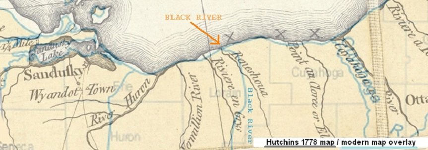
Thomas Hutchins holds the distinction of being the first person appointed as “Geographer of the United States” by Congress in 1781. His work implementing the Land Ordinance of 1785 created the systematic survey system that organized western territories into the familiar grid pattern of townships and sections that characterizes much of the American landscape today.
Hutchins’s survey methods established the Public Land Survey System that guided westward expansion for over a century. His detailed instructions for surveyors, astronomical observation techniques, and mapping standards created consistency across the vast western territories. Hutchins’s work made possible the orderly settlement of millions of acres and the establishment of clear property boundaries that supported economic development and territorial organization.
These forgotten explorers collectively mapped millions of square miles of American territory, established crucial travel routes, and provided the geographic foundation for westward expansion. Their detailed observations of landscapes, resources, and peoples shaped American understanding of the continent and influenced national development for generations. While names like Lewis and Clark dominate popular memory, these lesser-known figures deserve recognition for their essential contributions to American geography and exploration history.

Besides founding Festivaltopia, Luca is the co founder of trib, an art and fashion collectiv you find on several regional events and online. Also he is part of the management board at HORiZONTE, a group travel provider in Germany.
