

- The Literary Movements That Defined American Culture - June 20, 2026
- How Music and Literature United to Shape American Culture - June 20, 2026
- 20 Books Written by Women That Changed U.S. History - June 20, 2026
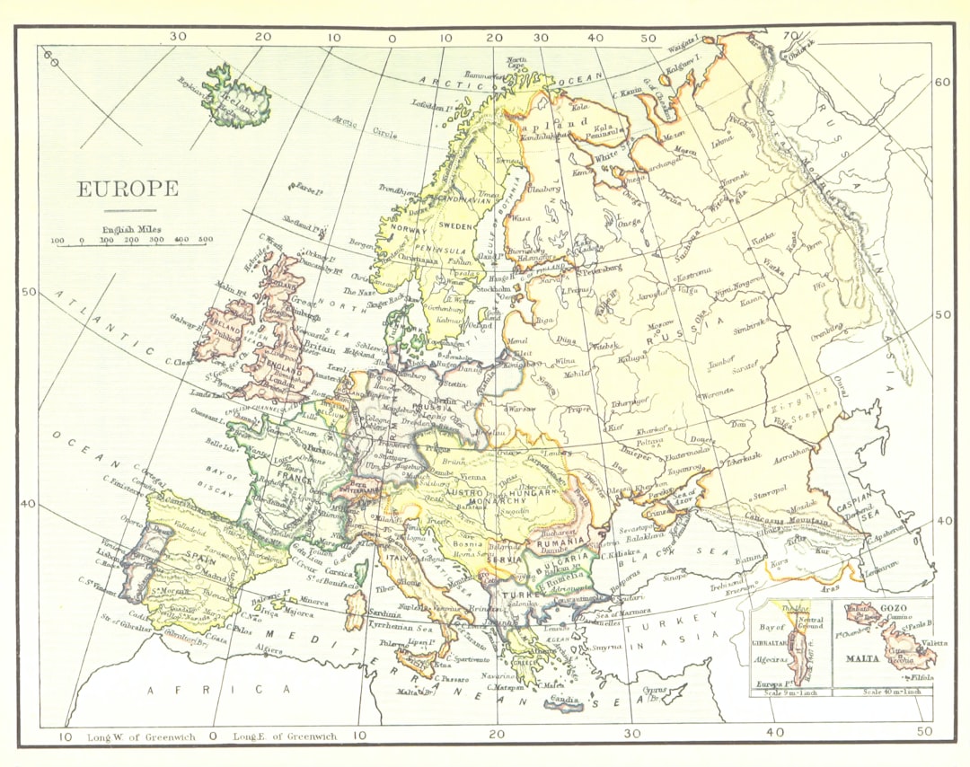
1. The Iron Curtain (1945–1991)
The Iron Curtain wasn’t just a line on a map—it was a looming presence that haunted Europe for almost half a century. Stretching from the Baltic Sea in the north to the Adriatic in the south, it sliced through countries, families, and lives with chilling efficiency. This border divided Soviet-aligned Eastern Bloc nations like Poland, East Germany, and Hungary from the Western democracies of France, West Germany, and Italy. The Iron Curtain was more than barbed wire and watchtowers; it was a psychological wall that bred suspicion and paranoia. Schools, jobs, and even love lives were shaped by which side you lived on. By the time it finally fell in 1991, millions had been affected, and the world watched in awe as old enemies hugged at new border crossings. The end of the Iron Curtain led to massive migrations, economic shocks, and the birth of new democracies that still shape Europe today.
2. The Berlin Wall (1961–1989)
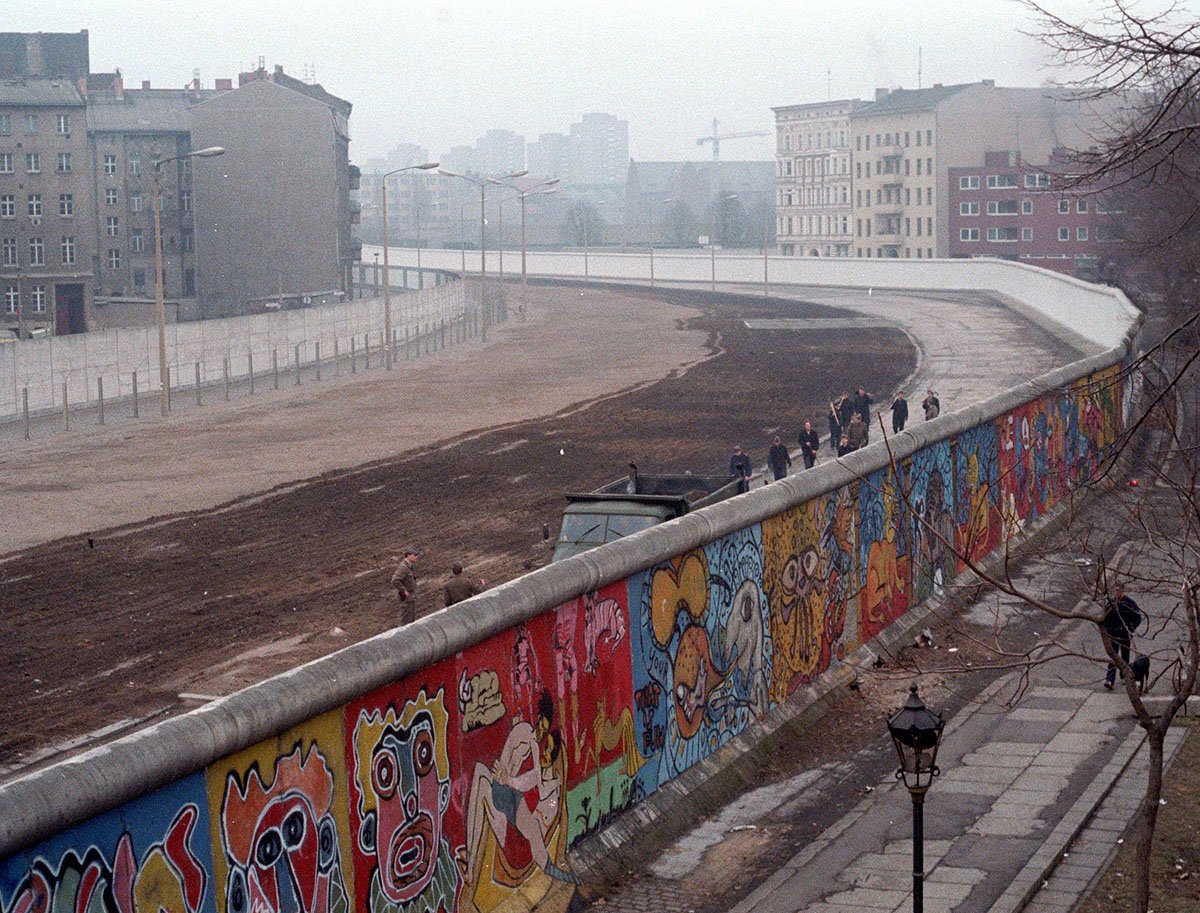
The Berlin Wall was the Cold War’s most infamous scar, a slab of concrete that cleaved Berlin—and the world—right down the middle. Erected overnight in August 1961, it instantly separated friends, lovers, and families without warning. Armed guards, floodlights, and death strips kept East Berliners trapped, and over 100 people died trying to escape to freedom. The wall stood for 28 years, its graffiti-covered surface becoming a symbol of oppression and longing. When crowds finally battered it down in November 1989, scenes of celebration were broadcast worldwide. The fall of the wall signaled not just the reunification of Germany but the unraveling of the entire Eastern Bloc. Today, fragments of the wall stand as haunting reminders of how easily a city—and a world—can be split.
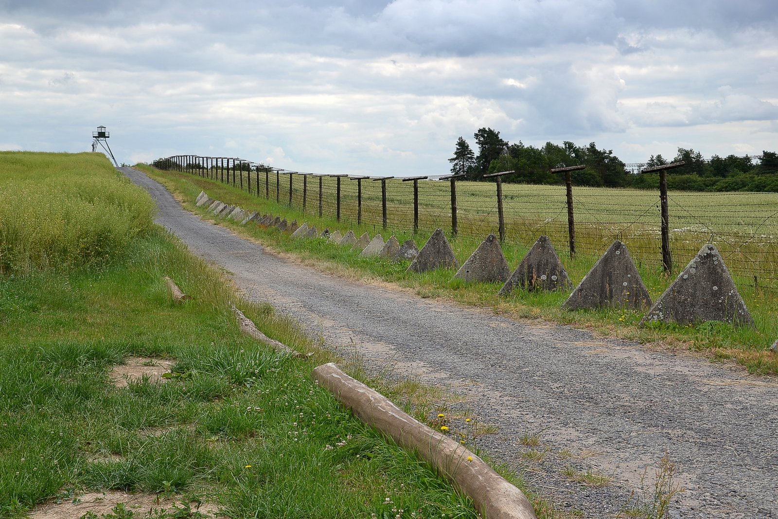
3. The Inner German Border (1949–1990)
While the Berlin Wall cut through one city, the Inner German Border ran the length of the country, stretching 1,393 kilometers from the Baltic Sea to Czechoslovakia. It was a high-security zone, lined with barbed wire, watchtowers, and landmines, separating East and West Germany with ruthless efficiency. Entire villages vanished as residents were relocated to prevent escapes. For decades, families could wave to each other across the divide but rarely meet. The border created two very different Germanies—one shaped by Soviet communism, the other by Western capitalism. When the border finally opened in 1990, the euphoria of reunification was mixed with the challenge of merging two societies that had drifted apart. The scars of this border are still felt in Germany’s politics and culture today.
4. The Sudetenland Border (1938–1945)
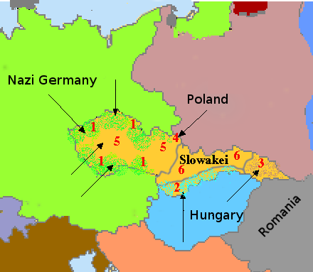
The Sudetenland border in Czechoslovakia became infamous when Hitler annexed it in 1938, claiming to protect ethnic Germans living there. This region’s transfer was at the heart of the Munich Agreement, a desperate—and ultimately futile—attempt to prevent another world war. During Nazi occupation, the border marked a brutal shift as Czechs and Germans were pitted against each other. After World War II ended in 1945, the border was redrawn, and millions of ethnic Germans were expelled in one of the largest forced migrations in European history. The Sudetenland’s changing borders highlight how lines on a map can uproot lives and fuel decades of tension and resentment.
5. The Austro-Hungarian Border (1867–1918)
The Austro-Hungarian Empire was a patchwork of ethnicities and languages, held together by a maze of internal borders. From Vienna to Budapest, these divisions marked where Austrians, Hungarians, Czechs, Slovaks, and others lived, often creating friction and confusion. The empire’s dual monarchy system meant that Austrians and Hungarians shared power, but minorities struggled for recognition. When the empire collapsed at the end of World War I, its borders shattered into new countries like Austria, Hungary, Czechoslovakia, and Yugoslavia. These new borders still influence Central European politics, as communities remember the days when their ancestors suddenly found themselves on the “wrong” side of a line.
6. The Confederate States of America (1861–1865)
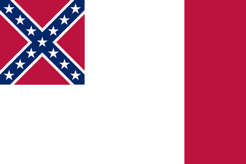
During America’s Civil War, the borders between the Union and the Confederate States were battle lines soaked in blood and heartbreak. Eleven Southern states broke away to form the Confederacy, defending slavery and their way of life. The borderlands—Kentucky, Missouri, and Virginia—became epicenters of fighting and chaos as neighbors chose sides. The war’s outcome in 1865 abolished slavery and redrew the map of the United States, but the old border scars still shape Southern identity and politics today. The Mason-Dixon Line, once the edge of the Confederacy, remains a powerful symbol in American culture.
7. The Danelaw Boundary (9th–11th Century)
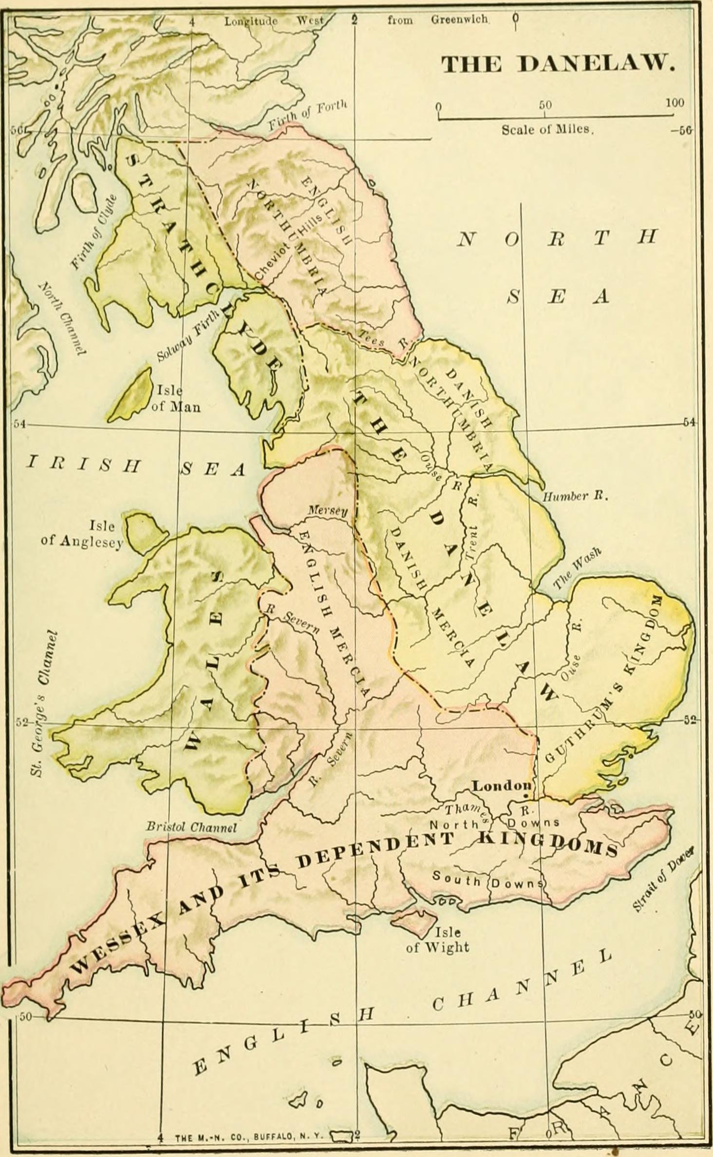
Long before England was one country, the Danelaw boundary separated Anglo-Saxon lands from those ruled by Viking invaders. After years of brutal raids, a treaty in the late 9th century gave Vikings control over a huge swath of northern and eastern England. This invisible line changed everything—laws, language, and daily life became a unique blend of Norse and Saxon. For two centuries, the Danelaw stood as a reminder of foreign conquest and adaptation. Eventually, the boundary faded as England unified, but traces of Viking influence still linger in local dialects and place names.
8. The Roman Limes (1st–5th Century AD)
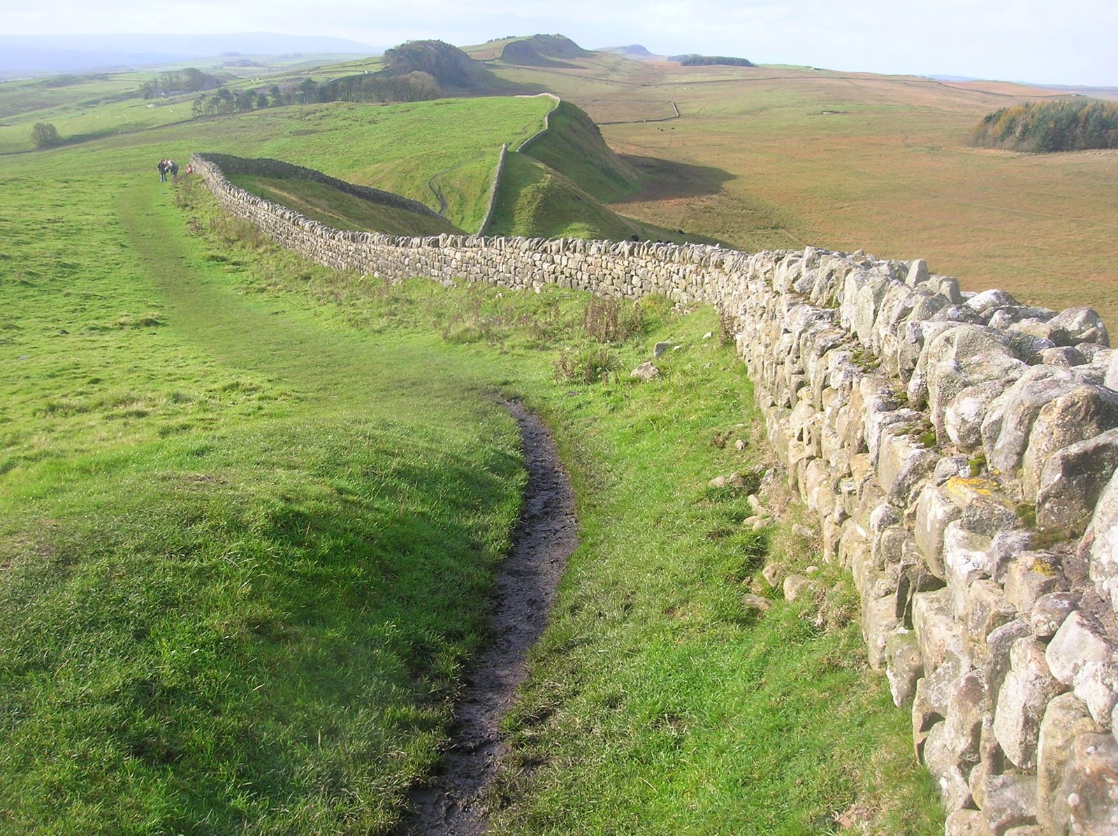
The mighty Roman Empire was held together by the Limes—a network of walls, forts, and watchtowers stretching thousands of kilometers from Scotland to the Middle East. These fortified borders marked the edge of Roman civilization, keeping out “barbarians” and controlling trade. Soldiers patrolled these frontiers, and towns sprang up in their shadow. When the empire began to crumble in the 5th century, the Limes fell, opening Europe to waves of migration and invasion. Today, ruins like Hadrian’s Wall in England serve as silent witnesses to a vanished world order.
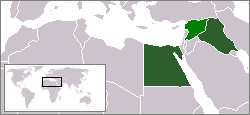
9. The Sykes–Picot Line (1916)
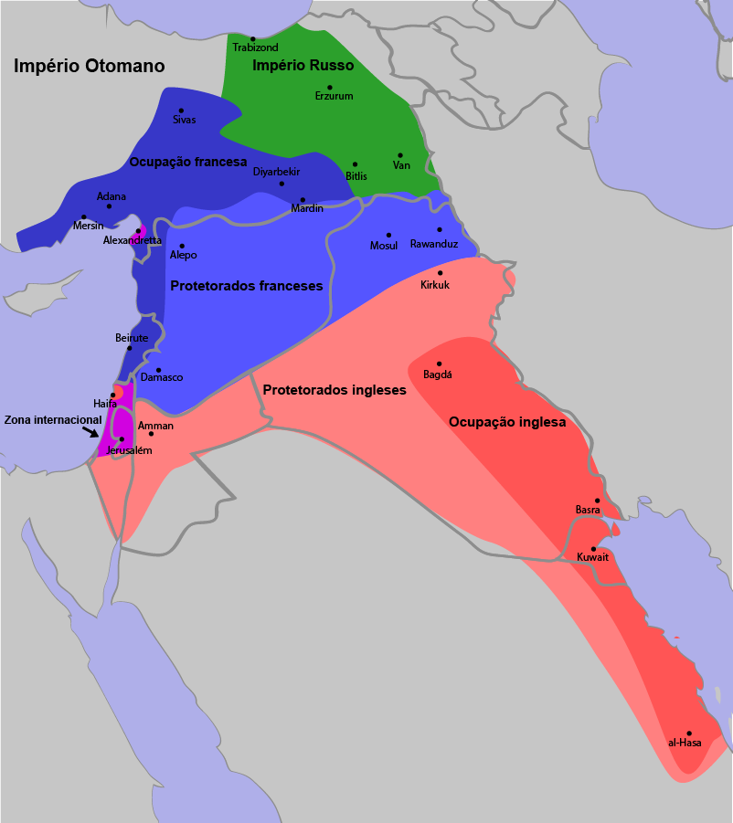
The Sykes–Picot Line was drawn in secret by British and French diplomats in 1916, carving up the Ottoman Empire’s Middle Eastern lands with little regard for the people living there. This arbitrary border sliced through ethnic and religious communities, planting the seeds for a century of conflict. Iraq, Syria, Lebanon, and Palestine—today’s headlines still echo with the repercussions of this deal. Many historians and analysts point to the Sykes–Picot Line as a root cause of the region’s endless struggles, as the line ignored historical realities on the ground.
10. The Durand Line (1893–Present, disputed)
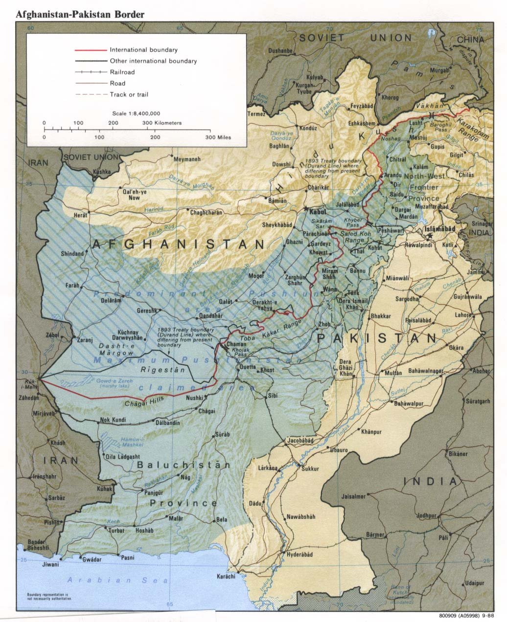
The Durand Line was drawn in 1893 by British colonial officials to separate Afghanistan from British India (now Pakistan). Stretching over 2,600 kilometers, it cut through tribal lands, dividing Pashtun communities with little warning or regard. Ever since, it’s been a flashpoint—Afghanistan has never recognized the border, and it remains heavily patrolled and disputed to this day. The Durand Line has shaped regional politics for over a century, fueling cross-border tensions, smuggling, and insurgencies that affect millions of lives.
11. The Korea-Japan Boundary (pre-1910)
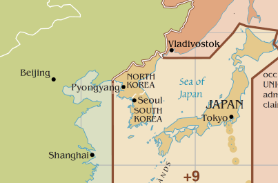
Before 1910, the Korea-Japan boundary across the Korea Strait marked the frontier between two distinct cultures and kingdoms. This natural border was both a barrier and a bridge, with centuries of trade, war, and migration passing over its waters. When Japan annexed Korea in 1910, the boundary vanished, erasing centuries of independence. The effects of this lost border still echo in the strained relations between Korea and Japan, as historical wounds remain fresh for many.
12. The Bengal-Bihar Border (Partition of Bengal, 1905–1911)
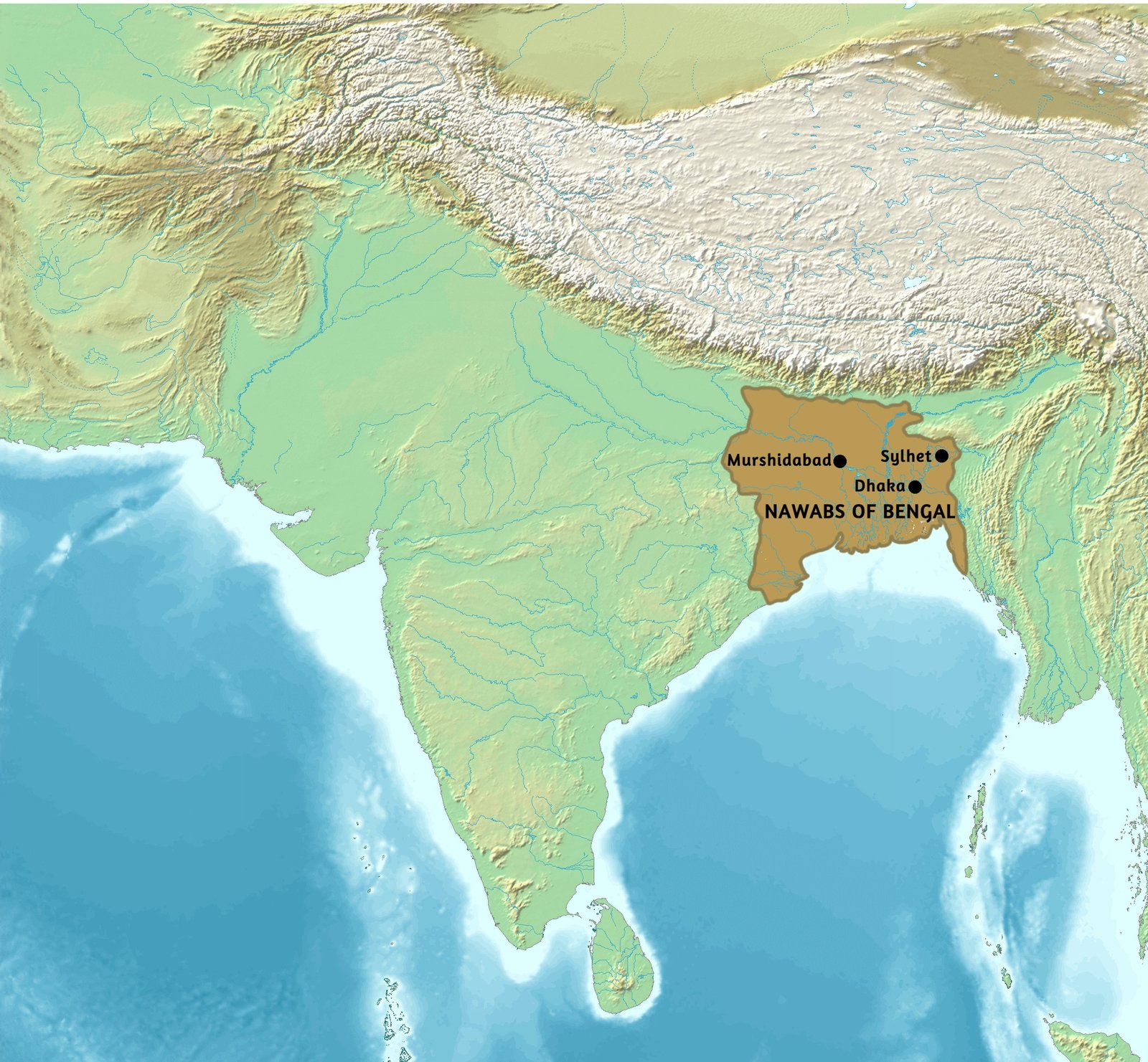
For just six years in the early 20th century, British rulers split Bengal along religious lines, creating a new border between Bengal and Bihar. This division was meant to improve administration but sparked widespread protests, as families and communities were split apart. The partition was reversed in 1911, but the memory of that short-lived border fed into the later, much larger partition of India in 1947. The Bengal-Bihar boundary reminds us how even temporary lines can leave lasting marks on people’s hearts and histories.
13. The United Arab Republic Border (1958–1961)
In a surge of pan-Arab optimism, Egypt and Syria merged to form the United Arab Republic in 1958. For three brief years, their internal border was erased, symbolizing hopes for Arab unity. But political tensions and cultural differences quickly resurfaced. In 1961, Syria seceded, and the border was reestablished, dashing dreams of a united Arab world. The fleeting nature of the UAR border highlights the challenges of merging distinct nations, even when they share language and faith.
14. The Neutral Moresnet (1816–1920)
Neutral Moresnet was a tiny sliver of land caught between Belgium and Germany, created after the Napoleonic Wars due to a dispute over valuable zinc mines. For over a century, it was a curious no-man’s land with its own flag, anthem, and even attempts at creating a universal language. Residents lived under joint administration, enjoying unique freedoms and a wild sense of independence. In 1920, the territory was finally absorbed by Belgium, and its quirky border disappeared into history, but stories of its eccentricity still delight historians.
15. The Free State of Fiume (1920–1924)
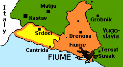
Fiume—now Rijeka in Croatia—became a flashpoint after World War I, claimed by both Italy and the new Kingdom of Yugoslavia. For four chaotic years, it existed as a free state, attracting revolutionaries, artists, and adventurers. Its borders shifted with the political winds, and the city became a laboratory for radical ideas. In 1924, it was annexed by Italy, and the Free State of Fiume vanished, but its brief existence is still celebrated as a symbol of resistance and creativity.
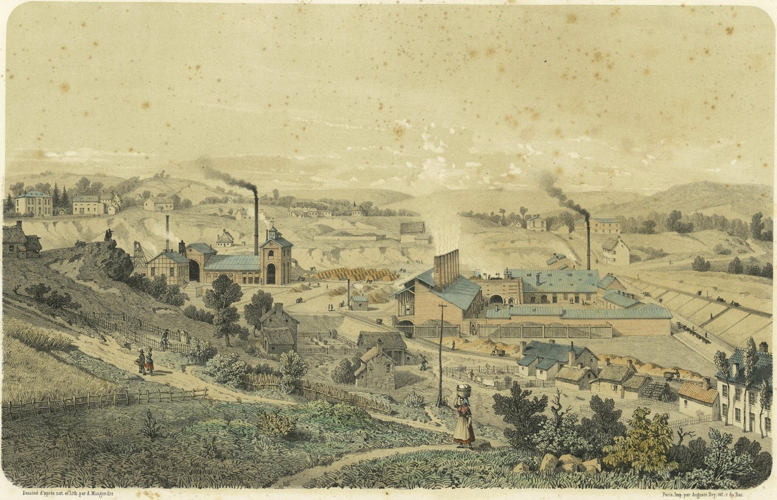
16. The Saar Protectorate (1947–1956)
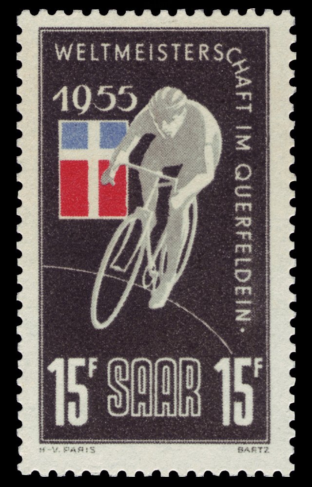
After World War II, the Saar region in western Germany came under French control, separated from the rest of Germany by a guarded border. With its rich coal mines, the Saar was economically vital, and France hoped to keep it. Saarlanders developed their own identity, with a unique flag and even a football team. In a 1955 referendum, residents voted to rejoin West Germany, and the border disappeared in 1957, ending a decade of uncertainty and cross-border tension.
17. The Gran Colombia Borders (1819–1831)
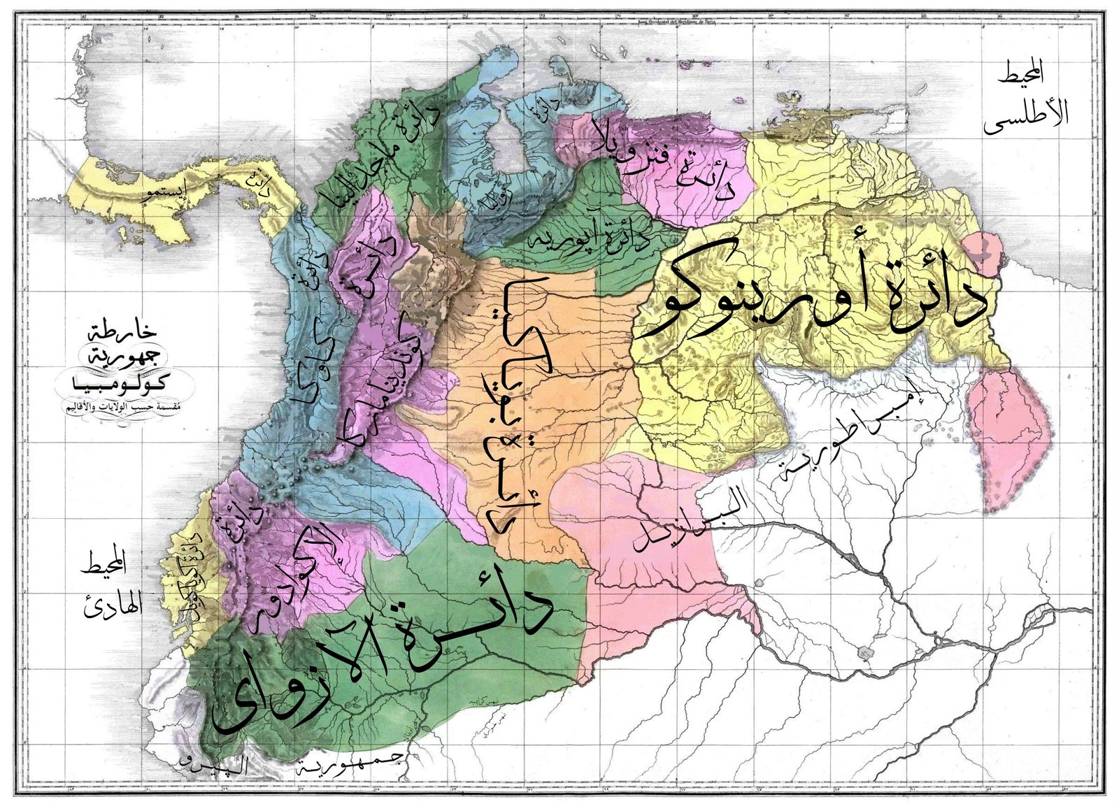
Gran Colombia was a grand experiment—a single nation uniting modern-day Colombia, Venezuela, Ecuador, and Panama. For a brief time, its borders stretched across northern South America, inspired by Simón Bolívar’s dream of unity. But regional differences and rivalries soon tore it apart. By 1831, Gran Colombia had fragmented into separate countries, each drawing new borders that reflected local identities. The memory of Gran Colombia still sparks debates about unity and division in Latin America.
18. The Kingdom of Hawai’i Border (1795–1898)
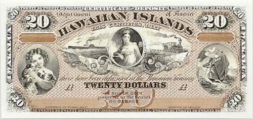
Before becoming a U.S. territory, Hawai’i was an independent kingdom with its own royal borders, laws, and traditions. The Hawaiian Islands formed a unified state under King Kamehameha in 1795, maintaining sovereignty for over a century. In 1898, the United States annexed Hawai’i, erasing the kingdom’s borders and triggering a legacy of cultural loss and resistance. Native Hawaiians continue to remember and honor the old kingdom’s borders, keeping the spirit of independence alive.
19. The Northwest Territory Border (1787–1803)
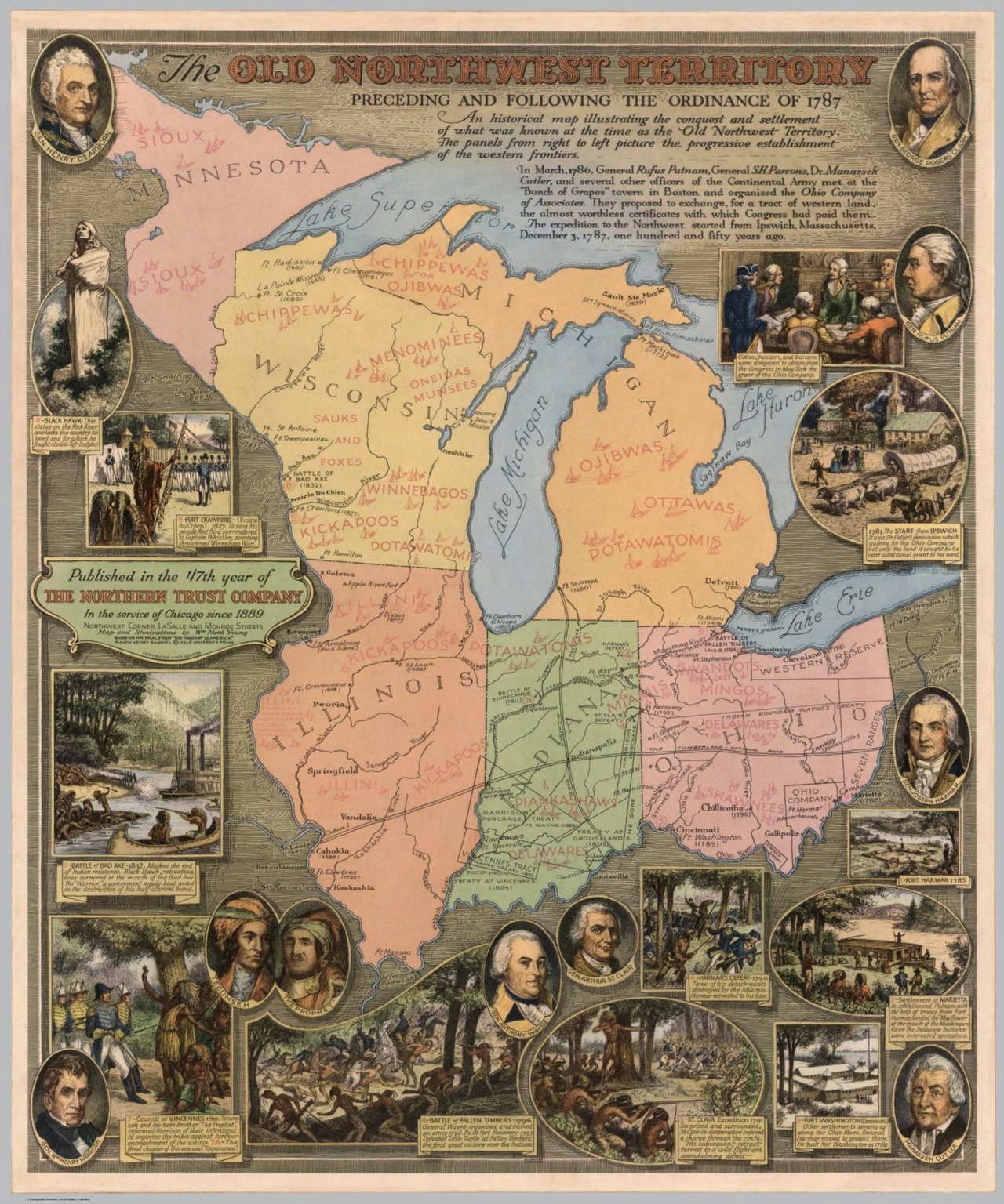
The Northwest Territory was America’s first great experiment in expansion, covering what would become Ohio, Indiana, Illinois, Michigan, Wisconsin, and part of Minnesota. Its borders were drawn by Congress in 1787, carving up Indigenous lands with little negotiation or consent. Over the next 16 years, the territory was split into new states, each with its own borders and identity. The Northwest Territory’s boundaries set the stage for America’s westward push—and the conflicts that followed.
20. The Republic of Texas Border (1836–1845)
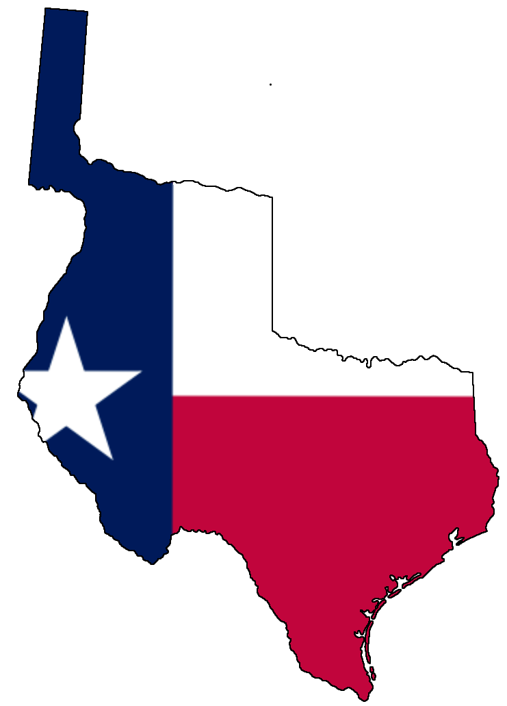
For nine wild years, Texas was its own country, complete with a president, army, and fiercely disputed borders. The Republic claimed land stretching from the Rio Grande to the Red River, but Mexico refused to recognize these lines. Battles, treaties, and shifting alliances kept the borders in flux until Texas joined the United States in 1845. Today, the Republic of Texas remains a powerful symbol of independence and pride, and its old borders fuel debates over identity in the Lone Star State.

CEO-Co-Founder
